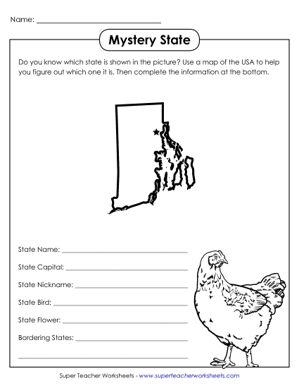
Map of Rhode Island Printable State Maps PDF Worksheet
Map of Rhode Island
Explore the Ocean State with our 'Map of Rhode Island' printable PDF, perfect for grades 4-5! This engaging resource features a labeled color map showcasing cities, bodies of water, and neighboring states. A special section highlights Rhode Island's state tree, flower, and bird, making it an ideal tool for classroom instruction, homework, or review. Enhance your students' learning experience and strengthen their geography skills with this fun and educational activity.
This worksheet is recommended for students in Fourth Grade and Fifth Grade.
")

You May Also Be Interested In