Map of Washington, D.C. (Full Color) Printable State Maps Washington Dc Color PDF Worksheet
Map of Washington, D.C. (Full Color)
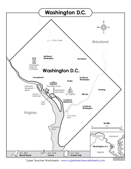
Enhance your classroom teaching experience with our "Map of Washington, D.C. (Full Color)" printable PDF. Perfect for 4th and 5th-grade students, this resource includes a vibrant map featuring key landmarks, the Potomac River, and neighboring states. It's an excellent tool for teaching geography, fostering engagement and fun learning. Ideal for use in elementary classrooms or as a homework activity, it helps students practice and review their map-reading skills while providing clear answers to their questions about the U.S. capital.
This worksheet is recommended for students in Fourth Grade and Fifth Grade.
 (Printable PDF Worksheet)")

You May Also Be Interested In