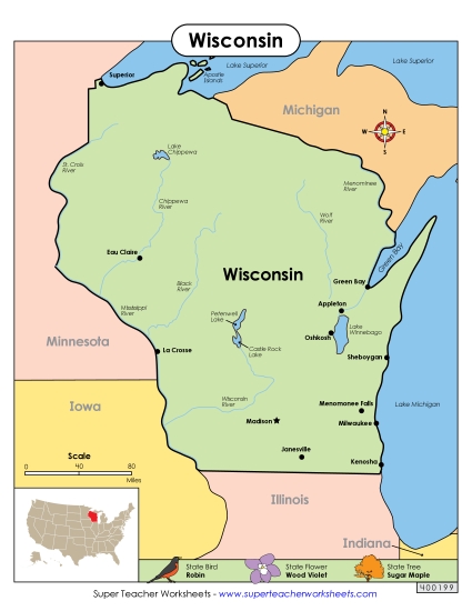
Wisconsin Map (Labeled) Printable State-maps PDF Worksheet
Wisconsin Map (Labeled)
Enhance your geography lessons with our "Wisconsin Map (Labeled)" PDF worksheet. Ideal for elementary classrooms and homeschooling, this resource makes learning about Wisconsin's key cities fun and engaging. It's perfect for teaching state geography, offering a clear layout with major cities like Milwaukee and Madison labeled. Use it for review, study sessions, or homework to help students practice and solidify their knowledge in primary school grades. This printable activity is a valuable tool for any educational setting.
This worksheet is recommended for students in Third Grade, Fourth Grade, Fifth Grade and Sixth Grade.
Common Core Standards:
ignored.
")

You May Also Be Interested In