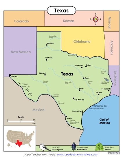
Texas Map (Labeled) Printable State-maps PDF Worksheet
Texas Map (Labeled)
Enhance your teaching toolkit with our "Texas Map (Labeled)" printable PDF. Perfect for elementary school classrooms, this resource offers a fun and engaging way for students to learn about Texas geography. They can practice identifying major cities, the Rio Grande, the Gulf of Mexico, and adjacent states. Ideal for classroom instruction, homework, or as a study review, this PDF helps reinforce geographic skills and provides answers to common questions about Texas's layout.
This worksheet is recommended for students in Third Grade, Fourth Grade, Fifth Grade and Sixth Grade.
Common Core Standards:
ignored.
")

You May Also Be Interested In