Pennsylvania Map (Labeled) Printable State Maps Labeled PDF Worksheet
Pennsylvania Map (Labeled)
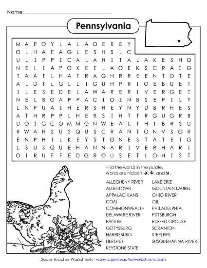
Explore Pennsylvania with our labeled map, perfect for elementary classroom use or homeschooling! This printable PDF resource helps students learn key locations like Erie, Scranton, and Philadelphia, and major landmarks such as the Susquehanna River and Lake Erie. Ideal for teaching geography, this worksheet allows for engaging review and practice of state-specific knowledge. Use it to enhance study sessions, as fun homework, or as a helpful teaching tool in primary school grades.
This worksheet is recommended for students in Third Grade, Fourth Grade, Fifth Grade and Sixth Grade.
Common Core Standards:
ignored.
")

You May Also Be Interested In