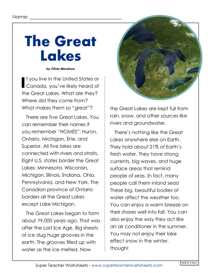
Michigan Map (Labeled) Printable State Maps Labeled PDF Worksheet
Michigan Map (Labeled)
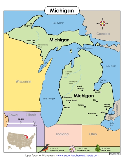
Enhance your classroom teaching resources with our "Michigan Map (Labeled)" PDF. Perfect for elementary instruction, this printable helps students learn about Michigan’s key locations, including major cities like Detroit and Lansing, as well as important water bodies such as Lake Michigan and Lake Erie. Ideal for geography lessons, this worksheet offers a fun way to engage students in learning and reviewing state geography through clear labels and easy-to-follow maps.
This worksheet is recommended for students in Third Grade, Fourth Grade, Fifth Grade and Sixth Grade.
Common Core Standards:
ignored.
")

You May Also Be Interested In