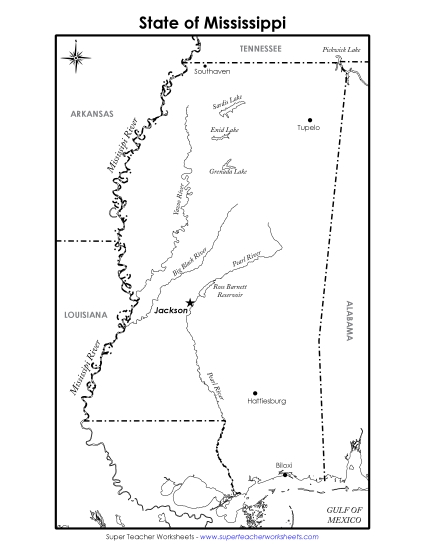
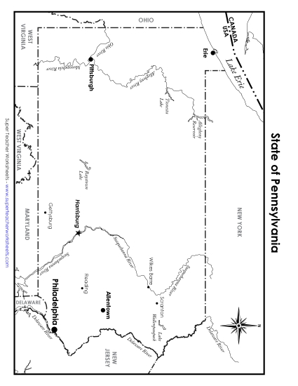
Colorado Map (Labeled) Printable State Maps Labeled PDF Worksheet
Colorado Map (Labeled)
Enhance geography lessons with our "Colorado Map (Labeled)" PDF worksheet, perfect for elementary classrooms or homeschooling. This resource helps students learn about Colorado’s major cities like Denver and Boulder, and important rivers such as the Colorado River. Ideal for teaching state geography, this printable is great for class reviews, engaging homework, or as a fun study activity. Equip your primary school grades with the skills to identify key locations and understand map features through this comprehensive and educational tool.
This worksheet is recommended for students in Third Grade, Fourth Grade, Fifth Grade and Sixth Grade.
Common Core Standards:
ignored.
")

You May Also Be Interested In