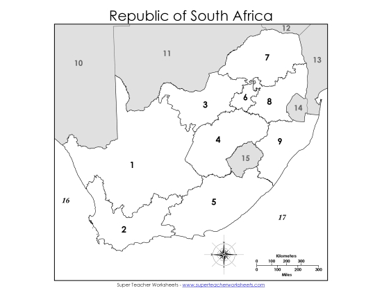
Capitals Map #1 Printable Maps South Africa Capitals1 PDF Worksheet
Capitals Map #1
Enhance your classroom learning experience with our "Capitals Map #1" printable PDF. Designed specifically for elementary students, this resource is perfect for teaching geography in primary school grades. It features major cities, provincial capitals, and the national capital of South Africa, plus borders with neighboring countries. Ideal for study, review, or homework, this activity engages students in fun, skill-building work on geography. Teachers and homeschoolers will find it a valuable addition to their instructional tools.
This worksheet is recommended for students in Third Grade, Fourth Grade, Fifth Grade, Sixth Grade, Seventh Grade and Eighth Grade.
")

You May Also Be Interested In