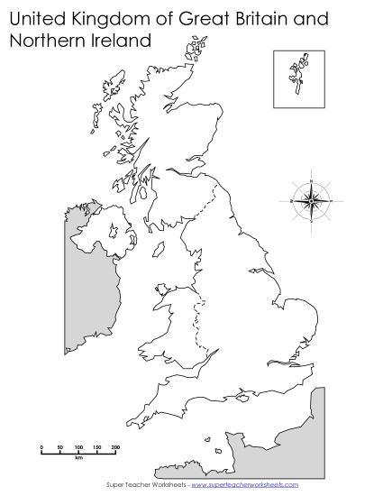
UK Map with Key Locations Printable United-kingdom PDF Worksheet
UK Map with Key Locations
Explore the UK with our "UK Map with Key Locations" printable PDF! This engaging resource is perfect for students in grades 1-8, making it a versatile tool for classroom instruction or homework. The worksheet includes a detailed map with labeled key locations such as capitals, major cities, bodies of water, and neighboring countries. It's designed to enhance learning, provide practice with geography skills, and help students review and retain information through fun, interactive study. Ideal for teachers and homeschoolers looking to boost their geography lessons!
This worksheet is recommended for students in First Grade, Second Grade, Third Grade, Fourth Grade, Fifth Grade, Sixth Grade, Seventh Grade and Eighth Grade.


You May Also Be Interested In