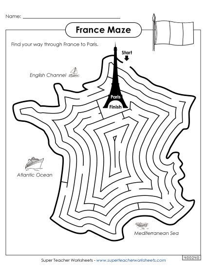
Map of France Printable PDF Worksheet
Map of France
Explore the geography of France with our engaging and educational Map of France worksheet, perfect for grades 1-8. This resource includes a colorful, labeled map highlighting major cities, regions, and bodies of water, as well as France's neighboring countries. Ideal for classroom learning, homework, or as a fun review activity, this printable PDF helps students practice their map skills and reinforces geographical knowledge. A black and white version is also available for additional coloring and labeling practice. Get this versatile teaching tool today to enhance your instruction and help students learn about France!
This worksheet is recommended for students in First Grade, Second Grade, Third Grade, Fourth Grade, Fifth Grade, Sixth Grade, Seventh Grade and Eighth Grade.


You May Also Be Interested In