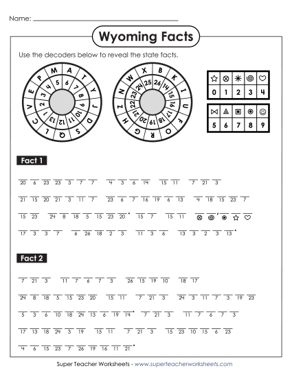
Map of Wyoming Printable State-maps PDF Worksheet
Map of Wyoming
Explore Wyoming's geography with our "Map of Wyoming" PDF worksheet, designed for grades 4 to 5. This educational resource helps students learn about Wyoming's major cities, rivers, lakes, mountains, and borders. It also features fun facts about the state's tree, flower, and bird. Perfect for classroom instruction, homework, or extra practice, this printable activity engages students in learning while they review and answer questions to enhance their geographic skills.
This worksheet is recommended for students in Fourth Grade and Fifth Grade.


You May Also Be Interested In