Map of Michigan Printable State-maps PDF Worksheet
Map of Michigan
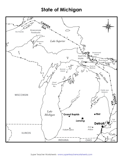
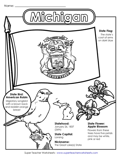
Explore the Great Lakes State with our "Map of Michigan" worksheet! Designed for 4th and 5th graders, this engaging resource helps students learn about Michigan's key cities, notable bodies of water, and neighboring states. It also features fun facts, including the state tree, flower, and bird. This printable PDF is perfect for classroom instruction, homework, or as a study activity to reinforce geography skills. Teachers and homeschoolers will find it an invaluable tool to enhance learning and review.
This worksheet is recommended for students in Fourth Grade and Fifth Grade.


You May Also Be Interested In