Map of Kentucky Printable State-maps PDF Worksheet
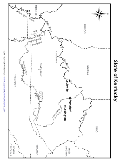
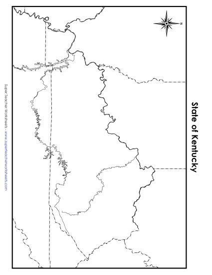
Map of Kentucky
Explore the geography of Kentucky with our engaging, full-color Map of Kentucky printable PDF worksheet. Designed for students in grades 4 to 5, this resource makes learning fun and effective. Ideal for classroom instruction or homework, it helps students identify major cities, rivers, and bordering states. This activity enhances geographical skills and is a perfect addition to any elementary teaching toolkit.
This worksheet is recommended for students in Fourth Grade and Fifth Grade.


You May Also Be Interested In