Map of Indiana Printable State-maps PDF Worksheet
Map of Indiana
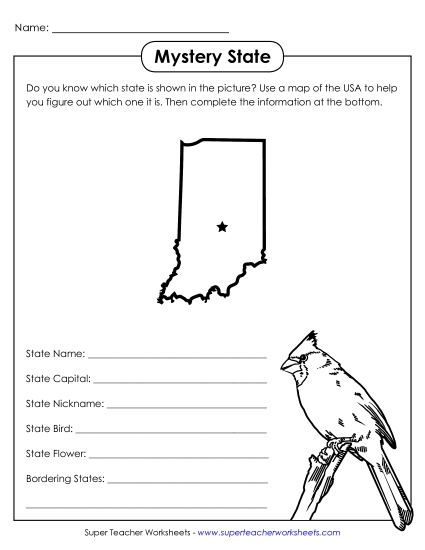
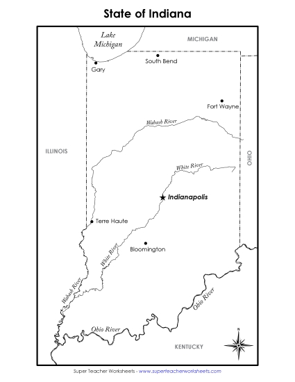
Explore the state of Indiana with our engaging and educational printable PDF worksheet, perfect for 4th and 5th graders. This detailed map highlights Indiana's cities, waterways, and neighboring states, and includes fun sections on the state flower, bird, and tree. Ideal for classroom learning, homework review, or homeschool instruction, this resource helps students practice and reinforce their geography skills through interactive questions and answers. Equip your students with the knowledge and tools they need to excel in their studies!
This worksheet is recommended for students in Fourth Grade and Fifth Grade.


You May Also Be Interested In