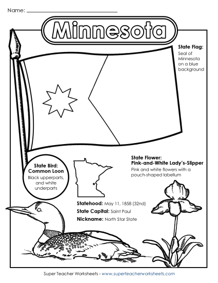
Minnesota Map (Labeled) Printable State Maps Labeled PDF Worksheet
Minnesota Map (Labeled)
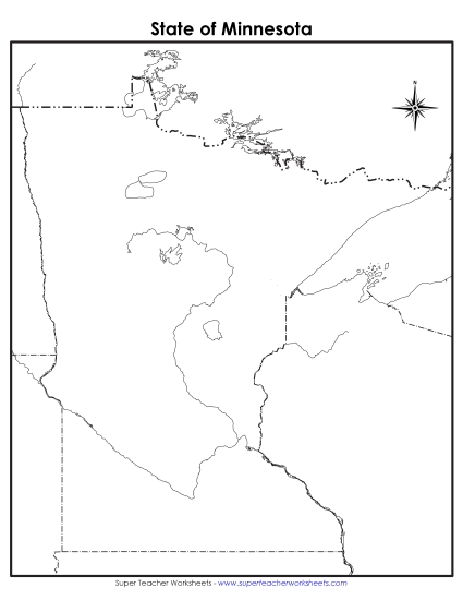
Enhance your teaching toolkit with our "Minnesota Map (Labeled)" PDF worksheet, perfect for elementary classrooms and homeschool settings. This printable resource offers a detailed view of Minnesota’s key cities like Duluth and Minneapolis, plus major waters like the Mississippi River. Ideal for geography lessons, this activity helps students learn and review state geography, engaging them in practice problems and enhancing their map-reading skills. Great for study sessions, classroom instruction, or fun homework tasks, it’s designed to boost geographical knowledge in primary school grades.
This worksheet is recommended for students in Third Grade, Fourth Grade, Fifth Grade and Sixth Grade.
Common Core Standards:
ignored.
")

You May Also Be Interested In