Free Map of the Middle Colonies Printable Colonial-america PDF Worksheet
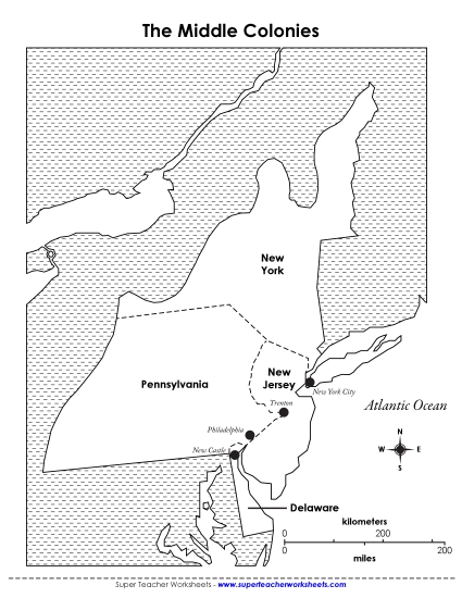
Map of the Middle Colonies
Explore the Middle Colonies with our engaging Grade 4 printable PDF worksheet titled "Map of the Middle Colonies." Ideal for classroom instruction or homeschooling, this resource offers a detailed 1775 map featuring New York, Pennsylvania, New Jersey, and Delaware. Perfect for teaching elementary students to learn and review geographical skills through fun and interactive questions and answers. Use this worksheet to enhance study, practice, and homework activities while building essential learning skills.
This worksheet is recommended for students in Fourth Grade.
Common Core Standards:
4.L.4.c.

You May Also Be Interested In


