Canada - Provinces & Capitals Printable PDF Worksheet
Canada - Provinces & Capitals
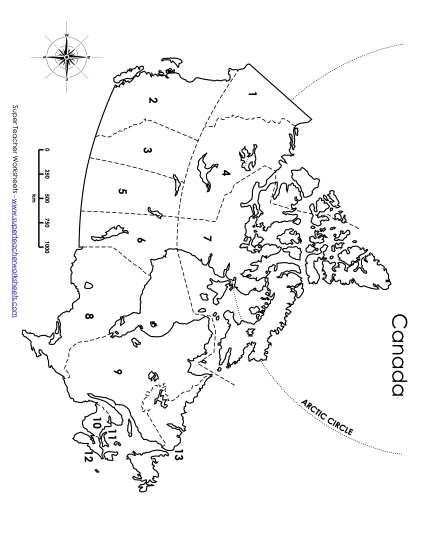
Explore the political landscape of Canada with our "Canada - Provinces & Capitals" PDF worksheet, perfect for grades 4-6. This resource offers a detailed map with labels for all provinces and territories, along with their capitals, making it an excellent tool for classroom instruction or homework. Teachers and homeschoolers can use this printable to engage students in learning, allow them to practice their geography skills, review key locations, and reinforce their knowledge through fun, interactive questions and answers. Ideal for teaching elementary students about Canada's geography!
This worksheet is recommended for students in Fourth Grade, Fifth Grade and Sixth Grade.
Common Core Standards:
5.L.4.c.


You May Also Be Interested In