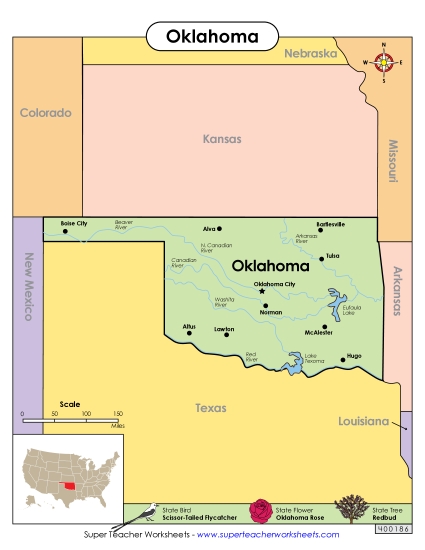
Oklahoma State Map (Labeled) Printable Maps Labeled PDF Worksheet
Oklahoma State Map (Labeled)
Explore the state of Oklahoma with our labeled map, perfect for elementary classroom use. This printable PDF is a fantastic resource for teachers and homeschoolers to engage students in learning about key locations in Oklahoma, including major cities and rivers. It's designed to make geography lessons fun and interactive, helping to enhance study, review, and practice of map-reading skills. Ideal for homework or as an in-class activity, this worksheet supports instruction in primary school grades by providing clear labels and prompts for discussion.
This worksheet is recommended for students in Third Grade, Fourth Grade, Fifth Grade and Sixth Grade.
 (Printable PDF Worksheet)")

You May Also Be Interested In