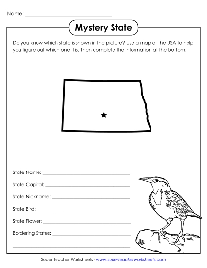
North Dakota State Map (Labeled) Printable Maps Labeled PDF Worksheet
North Dakota State Map (Labeled)
Enhance your teaching toolkit with our "North Dakota Map (Labeled)" PDF. Ideal for elementary classrooms and homeschooling, this resource helps students learn about North Dakota's key cities and waterways. Use this printable map for engaging geography lessons, fun class activities, or as a helpful study tool for homework. It's perfect for reinforcing geographic skills and ensuring students can identify and locate important landmarks in North Dakota. This worksheet is an essential resource for primary school grades looking to enhance their knowledge of U.S. geography.
This worksheet is recommended for students in Third Grade, Fourth Grade, Fifth Grade and Sixth Grade.
 (Printable PDF Worksheet)")

You May Also Be Interested In