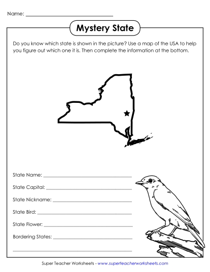
New York State Map (Labeled) Printable Maps Labeled Bw PDF Worksheet
New York State Map (Labeled)
Enhance your geography lessons with our "New York Map (Labeled)" worksheet. Perfect for elementary classrooms and homeschool settings, this printable PDF serves as a valuable resource to teach primary school grades about New York’s key locations. It includes labeled major cities, neighboring states, Canada, and significant bodies of water, making it an excellent tool for engaging students in learning through fun and interactive study. Ideal for practice, review, or homework, this worksheet helps reinforce geographical skills and knowledge.
This worksheet is recommended for students in Third Grade, Fourth Grade, Fifth Grade and Sixth Grade.
 (Printable PDF Worksheet)")

You May Also Be Interested In