Mississippi State Map (Labeled) Printable Maps Labeled PDF Worksheet
Mississippi State Map (Labeled)
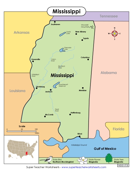
Explore the geography of Mississippi with our labeled map, perfect for elementary classroom use or homeschooling. This printable PDF resource enhances learning by allowing students to practice identifying major cities, lakes like Enid and Sardis, rivers such as the Mississippi and Yazoo, and other key locations. Ideal for teaching geography in primary school grades, it makes study, review, and homework engaging and fun. Equip your students with the skills to answer questions about Mississippi's geography with this educational activity!
This worksheet is recommended for students in Third Grade, Fourth Grade, Fifth Grade and Sixth Grade.
 (Printable PDF Worksheet)")

You May Also Be Interested In