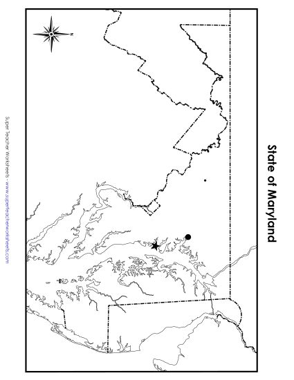
Maryland State Map (No Bordering States) Printable Maps Blank Only PDF Worksheet
Maryland State Map (No Bordering States)
Explore the state of Maryland with our engaging printable PDF worksheet, ideal for elementary teachers and homeschoolers. This resource, titled "Maryland Map (No Bordering States)," helps students learn about Maryland's geography without the distraction of adjacent states. Perfect for classroom review or homework, this activity encourages students to practice and reinforce their map-reading skills in a fun and focused way. Use it to enhance your teaching and help kids in primary school grades deepen their understanding of state locations and boundaries.
This worksheet is recommended for students in Third Grade, Fourth Grade, Fifth Grade and Sixth Grade.
 (Printable PDF Worksheet)")

You May Also Be Interested In