West Virginia Map (Labeled) Printable State Maps Labeled PDF Worksheet
West Virginia Map (Labeled)
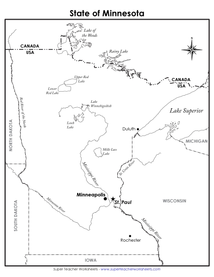
Explore the geography of West Virginia with our labeled map, perfect for elementary classroom use or homeschooling. This printable PDF serves as an excellent resource for teachers to engage students in learning about key locations in West Virginia. It includes cities like Charleston and Morgantown, as well as important water bodies such as the Ohio River. Use this worksheet for practice, review, or as a fun homework activity to enhance your students' map-reading skills and knowledge of primary school geography.
This worksheet is recommended for students in Third Grade, Fourth Grade, Fifth Grade and Sixth Grade.
 (Printable PDF Worksheet)")

You May Also Be Interested In