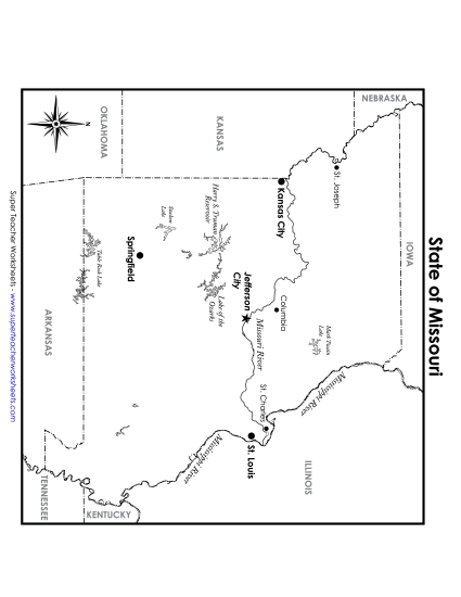
Ohio Map (Labeled) Printable State Maps Labelled PDF Worksheet
Ohio Map (Labeled)
Enhance your teaching toolkit with our "Ohio Map (Labeled)" printable PDF. Ideal for elementary classroom use or homeschooling, this resource offers a detailed map that features major cities, bodies of water, and bordering states. Perfect for geography lessons, this worksheet helps students learn about Ohio while engaging them in fun, interactive study. Teachers can use this as a handy review or practice tool to reinforce geography skills in primary school grades.
This worksheet is recommended for students in Third Grade, Fourth Grade, Fifth Grade and Sixth Grade.
 (Printable PDF Worksheet)")

You May Also Be Interested In