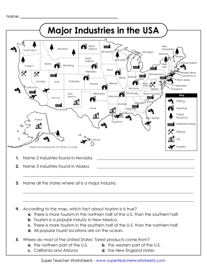
Using a Map Scale (Intermediate) Printable Maps PDF Worksheet
Using a Map Scale (Intermediate)
Explore the fundamentals of geography with our "Using a Map Scale (Intermediate)" worksheet! Perfect for elementary learners, this printable PDF resource is designed to engage students in practicing how to use a map scale to determine distances between cities in the USA. Ideal for classroom instruction, homework review, or homeschooling, it helps reinforce key mapping skills through fun and challenging questions. A valuable tool for teaching primary school grades about spatial concepts and problem-solving!
 (Printable PDF Worksheet)")

You May Also Be Interested In