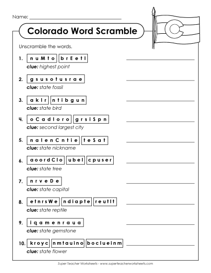
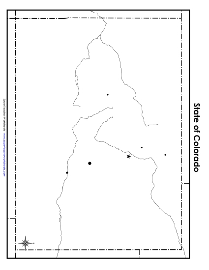
Labeled Colorado Map Printable State Maps PDF Worksheet
Labeled Colorado Map
Explore Colorado with our labeled map, perfect for grade 4 to 5 classrooms! This printable PDF is an excellent resource for teachers and homeschoolers to engage students in learning about geography. It helps with teaching location skills through fun and interactive activities. Ideal for study sessions, homework review, or as an instructional tool, this map includes cities, rivers, and mountains, complete with problems and questions to enhance learning.
This worksheet is recommended for students in Fourth Grade and Fifth Grade.
")

You May Also Be Interested In