Mexico States (Labeled; English) Printable Maps PDF Worksheet
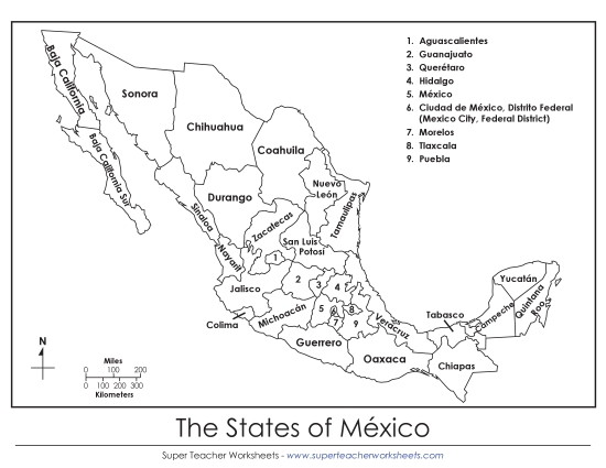
Mexico States (Labeled; English)
Enhance your teaching toolkit with our "Mexico States (Labeled; English)" PDF worksheet. Ideal for elementary classrooms and homeschool settings, this resource offers a fun way to engage students in learning about Mexico's geography. The printable map is perfect for practice, review, or homework, helping students in primary school grades reinforce their skills in identifying states and their capitals. This clear, easy-to-read map is a great activity for both group work and individual study.
This worksheet is recommended for students in Third Grade, Fourth Grade, Fifth Grade and Sixth Grade.


You May Also Be Interested In


