Free Canada - Provinces Map Printable PDF Worksheet
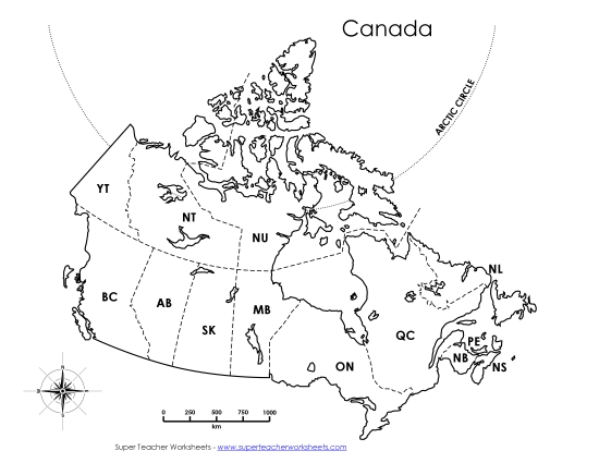
Canada - Provinces Map
Explore the geography of Canada with our "Canada - Provinces" printable PDF worksheet, designed specifically for grades 4 to 6. This resource offers a labeled political map that enhances learning and teaching about Canadian provinces and territories. Perfect for classroom review, homework, or as a study tool, this worksheet helps students practice their map-reading skills and reinforces geographic knowledge through engaging questions and answers. Ideal for teachers and homeschoolers looking to enrich their instruction and make learning fun.
This worksheet is recommended for students in Second Grade, Third Grade, Fourth Grade, Fifth Grade, and Sixth Grade.
- Common Core Standards
L.5.4c
")
You May Also Be Interested In